I had 4 nights booked in a small self-catering cottage in Chinley, near Chapel-en-le-Frith, slotted in just before the busy half-term week.
In the past when I’ve visited the Peaks it’s mainly been to hike the higher ground around Kinder Scout and Bleaklow, but this time I was looking to do some of the smaller hills (and valleys) that when I was fitter and younger, had turned my nose up at! I would be walking for 4 days including a quick stop-off on the way over, and also looking to get into Buxton for an hour or two, and visit the ‘plague village’ of Eyam, so wanted 4 short walks, say 3-5 miles, with lots of interest and great scenery (with each to be extendable a bit if I fancied it). These were my picks :
Shining Tor
(From Pym Chair Car Park. Postcode SK10 5XL, OS grid ref SJ994767)


This was the stop-off on the way; a quick 7 km out-and-back of a couple of hours along the ridge, with just 160 metres of height gain.
The ridge forms the border between Cheshire & Derbyshire, and Shining Tor is one of Cheshire’s ‘Three Peaks’, with great views over to Shutlingsloe (another of the three) in one direction, and overlooking Errwood Reservoir and Goyt Valley in the other. Extending the walk into the valley would make a great circular walk, and that’s been ‘bookmarked’ for another time, probably for May again, when the cotton grass is in full bloom!
Parkhouse Hill and Chrome Hill

I chose to park in Earl Sterndale – there’s room for about 10-15 cars by the church (postcode SK17 0BS, OS Grid Ref SK090670) – and took the signed footpath nearby which takes you over a couple of fields towards Parkhouse.

These two iconic and well-known hills together form the ‘Dragon’s Back’ ridge, and the views are just stunning. I’d seen lots of amazing photography before going, most of which was of the perfect Instagramable view of the ridge from a tree on the western side of Parkhouse. I tried to be clever, and in a hunt for an alternative less-photographed view wandered around the two hills a bit, rather than just up and down them. But learnt 2 things in my meanderings:
- if you’re going up Parkhouse Hill, the steep path up its eastern side might look a bit steep and scrambly, but take it anyway, because any other approach is just as steep, and maybe more so. Chrome Hill’s a bit more straightforward.
- Mobile phone reception can still be rubbish in some places. Although navigation here isn’t too difficult (in good visibility, your target does tend to stand out a bit!) it’s still a useful reminder that a downloaded or paper map is always a good idea.
Chee Dale & the Monsal Trail


From the car park and cafe at Miller’s Dale (postcode SK17 8SN, OS Grid Ref SK138732), as far as Blackwell Mill.
The outward leg of this one was a fantastic riverside walk, through a limestone gorge much of which is also within a Wildlife Trust Nature Reserve (a dipper, and an explosion of butterflies and other flying things put on a show while I was there), and which includes the famous stepping stones.
Parts of the route can flood in wet weather (no such problem after our recent dry spell) and you’ll need to be reasonably agile as there’s a certain amount of scrambling over rock involved, but it’s well worth it.

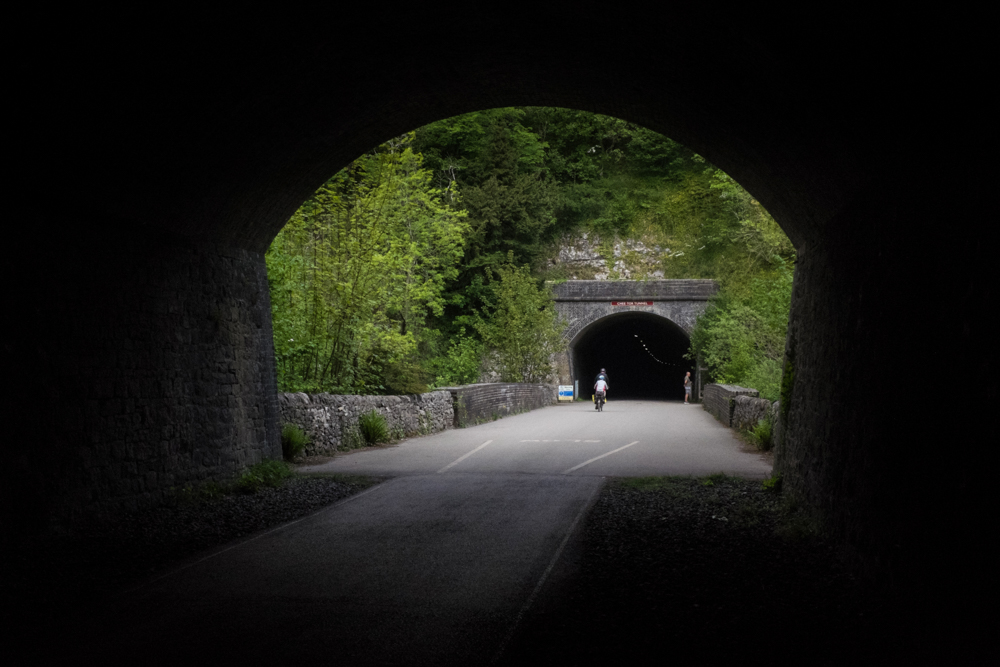
The return was along part of the Monsal Trail, on the paved/stoned former Manchester to London Midland Railway line through a couple of tunnels. In total, the Trail is an 8 mile route shared by walkers, cyclists and horse-riders, but my stretch was only about 2 miles, taking me back to car park in about 30 minutes flat compared to the outward leg which, including photo-taking and general loitering, had taken a couple of hours.
Mam Tor, Lord’s Seat and Rushup Edge

Mam Tor gets nearly a million visitors a year, and will need no introduction to most people reading this. I’d been there before, from Edale about 20 years ago, but felt the urge to refresh the memory. This time, I went up from the National Trust Car Park on the south-western side, at OS Grid Ref SK123832, for the steep but short climb, on the paved stepped path, to the summit.
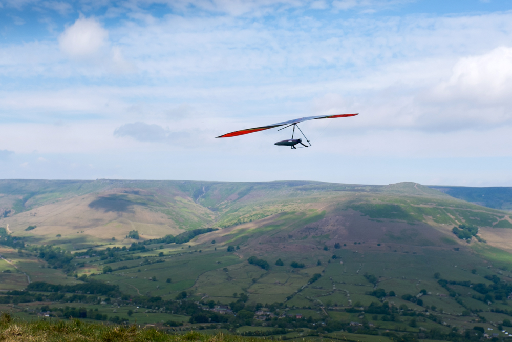

As great as it was to get the view towards Hollins Cross and the Great Ridge, I’ve got to say that the number of visitors, and the infrastructure necessary to manage them, makes it all feel a bit too ‘urban’ for me. So after a quick stop, I headed back down, and up towards Lord’s Seat and Rushup Edge, watching the hang gliders who use the slopes as a launching site along the way. It doesn’t take long to reach the Bronze Age barrow on the summit of Lord’s Seat (which at 550m is 33m higher than Mam Tor), and in stark contrast to the first half of the walk (and barring the 5 or 6 people I passed on the way) I had the place to myself.
A good week. As a bonus, and another contrast compared to previous Peak District visits, the weather stayed near-perfect, and I stayed completely dry. I might even go back again, soonish.

Leave a comment