Route Notes : Moel Famau via Moel Dywyll
Most beginners access Moel Famau from the car parks to the south near Bwlch Penbarras.
This is a longer walk, an out-and-back route from the car park near Moel Arthur to the north. A fairly strenuous 10 kilometre, 4 hour walk, with a total ascent of 440 metres (split, with 130 metres at the start, and then at various stages on an undulating route)

Distance 10 km approx. (6.2 miles), 440 m ascent.
Start point : Moel Arthur Car Park (OS Grid Ref SJ 146 657) on the minor road from Hendre to Llandyrnog. From Mold, take the Denbigh Road. After Hendre village, continue past the crossroads for Rhes y Cae and Cilcain, then take the next left by a stone cottage. Follow this road for about 2.5 miles to the car park by a cattle grid at the foot of Moel Arthur.
Route :
On the opposite side of the road to the car park, the main path ascends steeply from the road, and is clearly visible & signposted. If you don’t fancy a steep ascent so early, there’s a more gentle ascent on a diagonal path to your left (it crosses a boggy area, which may be tricky after wet weather) from the top of which you can turn right to follow a fence, and re-join the main path at a stile.
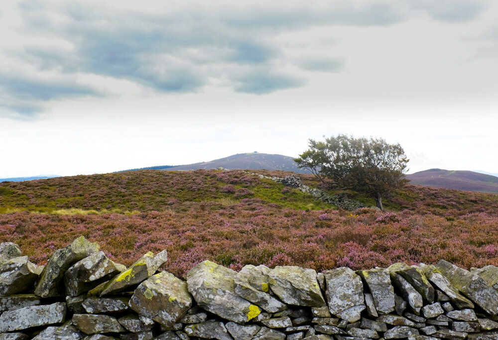
With superb views initially to Moel Arthur and Penycloddiau behind you, the path then turns from a southerly to a more easterly direction and the eventual target of the remains of the Jubilee Tower on Moel Famau comes into view in the distance, with Moel Dywyll in front and to its right.
The path (the Offa’s Dyke Path) is easy to follow and in good visibility (as long as you take care when coming back off Moel Famau to get back on the right route!) won’t present any major challenges. In poor visibility though, the challenge on this undulating route would be judging distance, and where exactly you are on the route, and some navigation skills would be useful!

